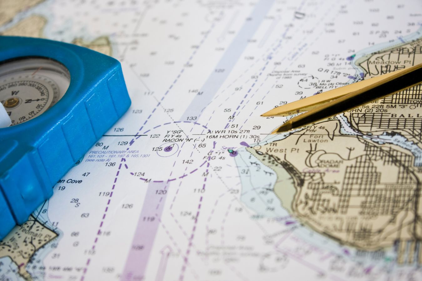
What is a nautical chart?
A nautical chart is a specialised type of map designed for maritime and aerial navigation. This graphic document provides detailed information about seas, coasts and navigable areas, helping mariners to plan safe routes and avoid potential hazards, especially when purchasing a new boat. Unlike ordinary maps, nautical charts focus on depicting critical navigational information such as depths, harbour locations, beacons and danger areas.
History and development of nautical charts
The origin of nautical charts dates back to the earliest maritime explorations, when navigators began to visually represent coastal features to improve the safety of their routes. Portulans, considered the forerunners of modern nautical charts, were used in the Mediterranean in the Middle Ages. These maps depicted coasts, islands and harbours with remarkable accuracy for their time, and were refined over time with advances in cartography and knowledge of the seas.
Today, nautical charts have been largely digitised, with navigation systems using GPS and real-time data. This facilitates navigation and improves accuracy, allowing skippers to make adjustments to their routes quickly.
Components of a nautical chart
Nautical charts include a variety of symbols, scales and colours representing different features and important data:
- Depths: Indicated in metres or feet, depths are essential to avoid dangerous areas for vessels of different draughts.
- Isobaths: These are lines joining points of equal depth, making it easier to interpret the contours of the seabed.
- Hazardous waters and obstructions: Mark areas with rocks, reefs, sandbanks or other potential hazards.
- Lighthouses and beacons: Charts indicate the position of lighthouses and beacons that serve as visual guides for navigation.
- Scales: Each chart has a scale that determines the accuracy and level of detail of the area depicted. Large scale charts show small areas in greater detail, while smaller scale charts cover large areas in less detail.
How to read and use a nautical chart?
Correctly interpreting a nautical chart is essential for safe navigation. Mariners must understand the symbols, colours and lines, and know how to identify safe navigation zones and areas of risk. For example, the colour blue usually represents shallow water, while white indicates deeper water. Hazardous areas may be marked with special symbols or specific colours indicating rocks, wrecks or dangerous currents.
The role of compass and compass in chart reading
To plot an accurate route on the chart, the compass and navigational compass are used. With these, navigators can calculate distances, orient their course and ensure they stay on course. The compass rose, which indicates the cardinal and subcardinal points, is a key feature of nautical charts, as it allows orientation and course adjustment based on the desired direction.
Types of nautical charts
There are different types of nautical charts that are adapted to the specific needs and routes of each navigation:
- General navigation charts: Used for long routes and open sea. They provide an overview, covering large areas with minimal detail.
- Coastal charts: These are ideal for navigating close to the coast and have details of harbours, bays and coastal features.
- Port Charts: These focus on specific areas, such as harbours and marinas, providing comprehensive details of local docks, services and navigational aids.
- Bathymetric charts: Although more scientific, these charts provide a detailed view of the relief of the seabed, useful for oceanographic studies and fishing.
The importance of nautical charts in maritime safety
Nautical charts are an essential tool for avoiding accidents at sea. They enable mariners to identify obstacles, assess routes and plan ahead. Charts also help anticipate changes in depth and bottom conditions, essential for deep-draft vessels.
Thanks to nautical charts, vessels can navigate more safely and avoid hazards, especially in difficult weather conditions or in areas congested by maritime traffic. In addition, nautical charts are also constantly updated to reflect changes in the marine environment, which is essential for maintenance and advice.
Digital nautical charts and modern navigation
Today, many navigators use digital nautical charts, which are integrated with global positioning systems (GPS) and radar. These electronic charts allow automatic updates, incorporate real-time data such as weather and maritime traffic, and optimise routes.
Digital charts can display additional information that makes navigation easier, such as tide forecasts and severe weather alerts. This not only improves accuracy, but also provides faster access to crucial data that can change in minutes.
Advice on the safe use of nautical charts
- Check the latest update: Ensure that the chart is up to date to reflect current sea conditions.
- Knowing the basic symbols: Familiarity with the symbols and colours is essential to interpret the cards correctly.
- Plan routes in advance: Mapping out a route before setting sail reduces the risk of encountering unexpected obstacles.
- Use appropriately scaled charts: Choose the correct chart according to proximity to shore or water depth.
Other news that may interest you
- Apps and technology that make sailing easier for beginners: Navigating has never been easier
- Tips for basic boat maintenance: Keep your boat ready to sail at all times
- Essential equipment for your first boat: What I wish I’d known before setting sail
- How much does boat insurance cost?
- In what wind is it dangerous to sail?

